
East Jeju
East Jeju holds the island's UNESCO trio — Seongsan Ilchulbong, Manjanggul lava tube, and Seopjikoji — plus the ferry gateway to Udo.
Quick facts
Top tours and experiences
We earn a small commission if you book through GetYourGuide — at no extra cost to you. Every tour is hand-picked and verified.
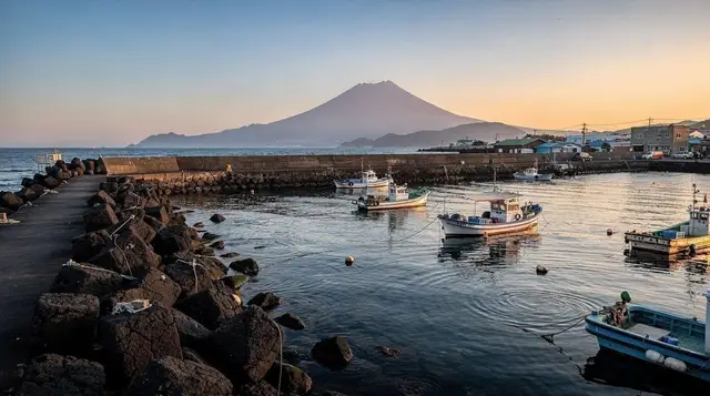
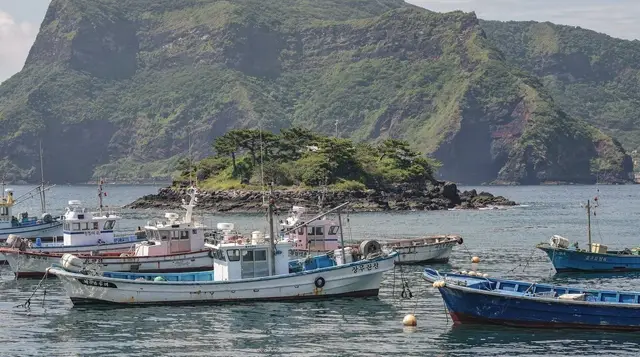
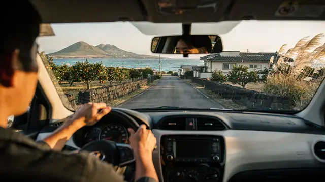
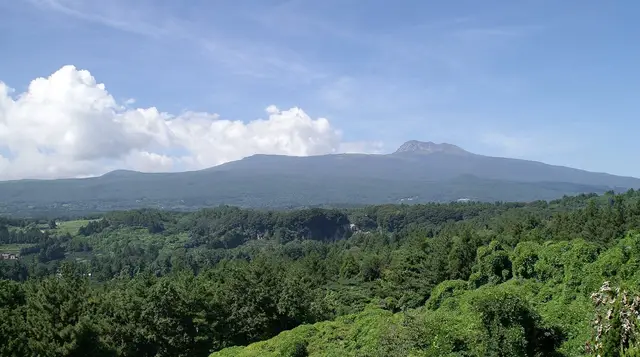

East Jeju is where the island’s UNESCO Global Geopark status concentrates most visibly: a volcanic tuff cone rising straight out of the sea at Seongsan, the largest lava tube system in the country running underground at Manjanggul, and a scatter of oreums (small volcanic cones) across a coastline that stays flatter and more agricultural than the mountainous interior. It’s also the departure point for Udo, the most-visited of Jeju’s outlying islets.
| Where | Northeast Jeju: Seongsan, Manjanggul, Udo, Gimnyeong, Woljeongri |
| Cost | Entry fees ₩3,000-5,000/site; Udo ferry ₩8,500-10,500 round trip |
| Time needed | 2-3 days to cover Seongsan, Manjanggul, and a Udo day trip |
| Getting there | 50-70 min drive from CJU airport; coastal road 1132 or cross-island route 97 |
| Best time | October for clear skies; dawn for Seongsan Ilchulbong |
What makes east Jeju distinct
Unlike west Jeju’s tea fields and stone-garden attractions, or Seogwipo’s waterfalls, east Jeju’s draw is geological drama viewed from outside and underground: a volcano you climb, a cave system you walk through, and a coastline shaped by tuff and basalt. Several towns here have their own dedicated destination pages — Seongsan, Seopjikoji, Gimnyeong, Hado, Woljeongri, Pyoseon, Sehwa, Jongdal, and Sinyang — this guide covers the region as a whole and the sites that span or sit between them.
Getting here and around
From CJU airport, east Jeju’s main sites are 50-70 minutes by car, with Seongsan at the far end near the 70-minute mark. There’s no expressway shortcut here; the coastal road (1132) or the cross-island 97 route are the main options, and both pass through agricultural land and small towns rather than tunneling through. Public buses run to Seongsan and Manjanggul from Jeju City, but frequency and coverage make a rental car strongly preferable if you’re trying to cover multiple sites in a day.
Within the region, distances are manageable: Seongsan to Manjanggul is about 20 minutes, Seongsan to the Udo ferry terminal is 5-10 minutes, and the coastal towns strung along the northeast shore (Gimnyeong, Woljeongri, Sehwa) are each 10-15 minutes apart.
Seongsan Ilchulbong (Sunrise Peak)
A volcanic tuff cone formed by an underwater eruption roughly 5,000 years ago, now a UNESCO World Natural Heritage site and the single most photographed landform on Jeju. The climb to the crater rim takes 20-40 minutes on a paved path with steps — moderate effort, not technical — and entry costs around ₩5,000. Sunrise here is genuinely spectacular and genuinely crowded; arriving 30-45 minutes before sunrise is the only way to get a clear viewpoint without shoulder-to-shoulder crowds in peak season. The full Seongsan Ilchulbong guide covers exact gate times by season, which shift with sunrise.
Jeju: UNESCO Sites & Sunrise Peak Hiking Small Group Tour handles the early transport logistics — arguably the hardest part of a sunrise visit if you’re not driving yourself in the dark on unfamiliar roads.
Manjanggul Lava Tube
The longest lava tube in the country, formed by flowing lava roughly 200,000-300,000 years ago. Only about a kilometer of the public section is open to walking, ending at an 7.6m lava column formation, but that stretch is enough to feel the scale: cool, echoing, and genuinely dark in sections (bring a jacket even in summer — it’s a constant 11-21°C underground). Entry costs around ₩4,000 and the walk takes 40-60 minutes round trip. Jeju: Private Transfer to Manjanggul Cave and Ticket bundles the ride out from central Jeju with entry, useful if you’re not renting a car for this specific stop.
Seopjikoji
A grassy headland near Seongsan with a lighthouse, sea cliffs, and — depending on the season — canola or cosmos flower fields that draw a heavy Korean domestic tourist crowd for photos. It’s free to walk the headland itself (a small fee applies to enter the flower fields when in bloom) and pairs naturally with a Seongsan visit given the short drive between them. Full details in the Seopjikoji guide.
Sangumburi Crater and Bijarim Forest
Inland from the coast, Sangumburi is a rare “maar” crater — flat rather than cone-shaped — with grassland covering its interior, reachable via a boardwalk (entry ~₩4,000). Bijarim Forest is a nutmeg-yew grove with some trees over 800 years old, walkable on flat, well-marked trails (entry ~₩3,000). Both are quieter alternatives to Seongsan if you want geological interest without the crowds — see the Sangumburi guide and Bijarim Forest guide for trail lengths and seasonal notes.
Udo Island
Udo (“cow island,” named for its shape) is a short ferry ride from Seongsan’s port and the most visited of Jeju’s outlying islets — flat, bikeable, ringed by beaches with an unusual coral-sand tint, and known for peanut ice cream sold at nearly every café. Ferries run frequently in good weather but are cancelled outright in high winds or rough seas, so build flexibility into any Udo day plan. Jeju: Udo Island E-Bike, Seongsan Ilchulbong & Speed Boat combines the crossing with e-bike rental, a practical way to cover the island’s roughly 17km perimeter road without renting a scooter locally. Full logistics — ferry schedules, ticket prices, bike rental comparisons — are in the Udo day trip guide and the Udo Island destination page.
Eastern day tours
For visitors without a rental car, several bus-based day tours cover east Jeju’s main sites in a single loop. Jeju Island: Full-Day East Jeju Bus Tour with Entry Fees bundles Seongsan, Manjanggul, and other stops with entry tickets included — a reasonable option if the driving logistics of a rental car (and finding parking at each site) feel like more hassle than they’re worth for a single day.
Where to stay
Seongsan itself has a growing cluster of guesthouses and small hotels aimed at the sunrise-hiking crowd, from budget dorms around ₩30,000/night to mid-range guesthouses at ₩80,000-120,000. Staying overnight in Seongsan is the only reliable way to make an early sunrise climb without a pre-dawn drive from Jeju City or Seogwipo. Alternatively, the coastal towns further north — Gimnyeong, Woljeongri — have a beach-town feel with cafés and smaller guesthouses.
A realistic two-day plan
Day one: drive out early, hit Manjanggul first while the cave is cool and uncrowded, then Bijarim Forest or Sangumburi Crater in the late morning, lunch in Seongsan town, and Seopjikoji in the afternoon for the headland walk. Overnight in Seongsan to be positioned for sunrise the next day. Day two: sunrise climb up Seongsan Ilchulbong (arrive 30-45 minutes early), breakfast in town, then a ferry to Udo for the rest of the day — e-bike around the perimeter road, lunch at one of the island’s cafés, and the return ferry by mid-afternoon with buffer time in case of delays. This covers the region’s core sights and the Udo add-on without over-scheduling either day.
Budget for a day in East Jeju
Entry fees are modest across the region: Seongsan Ilchulbong around ₩5,000, Manjanggul around ₩4,000, Sangumburi and Bijarim Forest ₩3,000-4,000 each. The Udo round-trip ferry runs ₩8,500-10,500, plus e-bike or bike rental (₩15,000-25,000 for a half-day). A casual lunch in Seongsan town runs ₩10,000-15,000 per person. Altogether, a full day covering two or three sites plus a meal comes to roughly ₩30,000-50,000 (about US$22-37) per person before accommodation — one of the more affordable regions on the island given how much of its appeal is outdoor and low-cost to access.
Photography timing
East Jeju rewards early starts more than any other region on the island: sunrise at Seongsan is the obvious case, but the flatter coastal light here also makes early morning and late afternoon the best windows for Seopjikoji’s cliffs and the coastal towns further north. Midday sun tends to wash out the coastal colors that make this region distinctive in photos. The Jeju photography spots guide covers specific vantage points in more depth.
Seasonal notes
East Jeju’s flatter, more exposed coastline means wind is a bigger factor here than in sheltered Seogwipo — winter visits can be genuinely blustery, and Udo ferries are the first thing to cancel in rough weather. Sunrise timing at Seongsan shifts with the season (as early as 5:15 a.m. in June, closer to 7:30 a.m. in December), so check current sunrise times rather than assuming a fixed hour. Typhoon season (late August-September) poses the highest cancellation risk for both the Seongsan climb (occasionally closed in extreme wind) and Udo ferries.
Weather and wind, specific to this coast
East Jeju’s exposure to open ocean on multiple sides means wind conditions here can differ noticeably from the more sheltered south coast on the same day — a calm morning in Seogwipo doesn’t guarantee calm conditions at Seongsan or on the Udo crossing. Checking a forecast specific to the Seongsan/Udo area rather than a general island-wide forecast is worth the extra step if a ferry crossing or the sunrise climb is central to your plans. Locals watching the coast for decades will tell you the same thing tourists learn the hard way: Jeju’s weather is genuinely local, varying meaningfully between regions that are only 40-50 minutes apart by car.
The coastal towns, compared
| Town | Character | Best for |
|---|---|---|
| Seongsan | Base town for the sunrise climb | Overnighting before Ilchulbong |
| Gimnyeong | Quiet turquoise beach, Manjanggul access | Families, calmer beach time |
| Woljeongri | Café-dense, busiest beach strip | Beach + café atmosphere |
| Sehwa | Local market, fewer tourists | A genuine, less-curated stop |
Renting gear locally versus bringing your own
For the Udo e-bike loop or a Seongsan sunrise climb, most visitors rent locally rather than bringing gear — bike shops near the Udo ferry terminal and hiking-adjacent shops in Seongsan town cover the basics (helmets, light jackets for the cave’s cool interior at Manjanggul) without needing to pack for it. The one exception worth planning ahead for is a headlamp or phone flashlight if you’re doing the pre-dawn Seongsan climb, since the trail lighting is minimal in the final approach before sunrise.
Frequently asked questions about East Jeju
Is Seongsan Ilchulbong worth the sunrise wake-up call?
Yes, if weather cooperates — it’s one of the genuine must-see sights on the island. Check the forecast the night before; a cloudy or rainy sunrise isn’t worth losing sleep over, and the crater is open and worth climbing at other times of day too.
How much time does Manjanggul actually take?
Budget an hour total including parking, ticket purchase, and the walk itself. It’s not a half-day commitment, which makes it easy to pair with Seongsan or Bijarim Forest on the same day.
Can I visit Udo without booking a tour in advance?
Yes — ferries run on a walk-up basis in normal conditions, though summer weekends get busy. Check the ferry schedule the morning of, since sailings depend on sea conditions and can be cancelled with little notice.
Is a rental car necessary for east Jeju?
Strongly recommended. Bus coverage exists between the major sites but is infrequent enough to make a full day of sightseeing difficult without a car or a guided bus tour.
How does east Jeju compare to west Jeju for a day trip from Jeju City?
Both are roughly an hour’s drive, but east Jeju’s sites (Seongsan, Manjanggul, Udo) are more spread along the coast and benefit from an overnight stay if you want the sunrise; west Jeju’s attractions cluster more tightly and suit a single long day trip better.
What’s the best month to see Seopjikoji’s flower fields?
Canola blooms in spring (April-May); cosmos flowers typically peak in autumn (September-October). Check current bloom reports before planning around a specific flower, since timing shifts year to year with weather.
Are there tourist traps to watch for in east Jeju?
Some roadside “themed” attractions near Seongsan charge admission for manufactured photo-op gardens with little connection to actual Jeju culture — the free headland walks at Seopjikoji and the geological sites (Seongsan, Manjanggul, Sangumburi) are the better use of both time and money.


