
Jeju Olle Trail: Overview (27 Routes)
What is the Jeju Olle Trail?
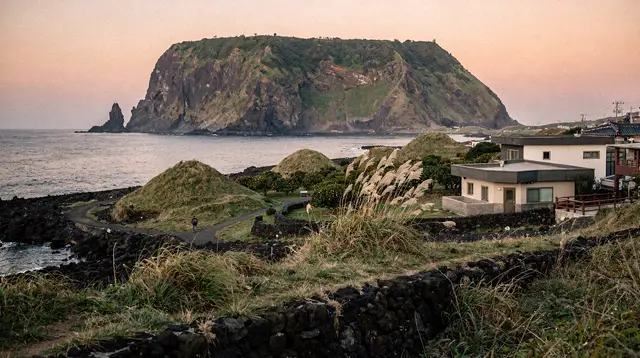
A network of 27 numbered walking routes — 21 main routes plus 6 shorter '-1' branch routes — totaling roughly 437km, circling most of Jeju Island's coastline and looping through the two offshore islets of Udo and Gapado. Routes are independently walkable — you don't need to complete the whole network.
The Jeju Olle Trail is a network of 21 main numbered coastal walking routes — plus 6 shorter “-1” branch routes, 27 in total — that together cover roughly 437km around the island’s perimeter, including loops onto Udo and Gapado islets. Launched in 2007 as a deliberate alternative to car-centric sightseeing, it remains one of the more genuinely distinctive things to do on Jeju: a way to see the coastline, small fishing villages, and farmland at walking pace rather than through a car window or tour bus.
| Scope | 21 main numbered routes + 6 “-1” branch routes (27 total), roughly 437km |
| Cost | Free to walk; optional passport booklet for stamps |
| Time needed | One route: half a day to a full day; full network: 3-4 weeks |
| Getting there | Most trailheads reachable by bus — designed for car-free walking |
| Best time | Spring or autumn for comfort; walkable year-round |
How the numbering and system works
Routes are numbered roughly in geographic sequence around the island, starting near Seogwipo and continuing clockwise (with some non-sequential branch routes inserted along the way, marked with a “-1” suffix, such as Course 1-1 on Udo Island). Each route has its own start and end point, typically near a town with bus access, and each is walkable independently — there’s no requirement to complete routes in order or to attempt the full network. Route lengths vary considerably, from short 3-4km branch routes to full-day 20km+ segments.
Trails are marked with blue and orange ribbons tied to poles, fences, and trees, supplemented by painted arrows on pavement and walls, and a horse-shaped mascot called Ganse marking key junctions and route information points. The marking system is generally reliable and one of the trail network’s genuine strengths, but a current route map (available from the official Jeju Olle Foundation and various trail apps) is still worth carrying, since a handful of unmarked or ambiguous forks exist on longer routes.
Which routes to prioritize
With 27 routes, most visitors reasonably ask which ones are worth the time. Course 7 (Seogwipo area) is one of the most consistently recommended for first-timers — coastal cliffs, a manageable length, and proximity to Seogwipo’s hotel and restaurant infrastructure for an easy return. Course 10 (Sanbangsan to Songaksan) covers dramatic mountain and coastal scenery in the island’s southwest. Both are covered in dedicated guides: Course 7 and Course 10.
Beyond those two, routes near Seongsan and the eastern coast tend to combine well with a visit to Seongsan Ilchulbong, while the islet routes on Udo offer a genuinely different, flatter walking experience paired with a short ferry crossing.
Guided walking options
For a lower-effort introduction to the trail network, Jeju: Sunset Tour Olle Trail Walking Tour with Hotel Pickup covers a scenic section with hotel pickup included, useful if you don’t want to manage route navigation and return transport independently, or if sunset timing specifically appeals.
If your base is Seogwipo and you’d rather see the town at walking pace without committing to a full route, an evening walking tour around Seogwipo timed for sunset is a gentler alternative. It pairs naturally with the Seogwipo culture walk, and it works as a rest-day activity between two longer courses.
Comparing the two most-recommended routes
| Course 7 (Seogwipo) | Course 10 (Sanbangsan-Songaksan) | |
|---|---|---|
| Distance | ~17.6km | ~15.6km |
| Scenery | Sustained coastal cliffs | Mountain, coast, and volcanic crater |
| Logistics | Easiest — bus at both ends, Seogwipo base | Moderate — buses less frequent |
| Best for | First-timers wanting easy return logistics | Visitors prioritizing varied scenery |
Full breakdowns: Course 7 guide and Course 10 guide.
How long a full thru-hike takes
Committed thru-hikers who set out to complete all 27 routes typically need three to four weeks of daily walking, and a small but genuine community of Olle Trail completionists exists, some returning to Jeju across multiple trips to finish the network. This is a minority pursuit — the large majority of visitors walk one to three routes as part of a broader Jeju trip rather than attempting the full network, and that’s a perfectly legitimate way to experience what the trail offers.
Difficulty and terrain
Olle Trail routes are overwhelmingly coastal and low-elevation, which keeps most of them accessible to reasonably fit walkers without hiking-specific experience — this is a meaningfully different profile from Hallasan’s mountain trails. That said, “coastal and low-elevation” doesn’t mean flat or shaded: expect exposed stretches along cliffs and farmland with limited shade, occasional uneven volcanic rock underfoot near the coast, and real distance on the longer routes. Check each route’s specific difficulty rating before committing, since they vary more than the uniform “easy coastal walk” reputation suggests.
Best season for Olle Trail walking
Spring (late March-May) and autumn (September-November) offer the most comfortable walking temperatures and the added bonus of cherry blossoms or canola flowers in spring and clear skies in autumn. Summer walking is genuinely tougher — heat, humidity, and limited shade on most coastal sections make midday walking uncomfortable, and monsoon rain in July plus typhoon risk from late August into September add cancellation risk. Winter is walkable and much quieter, though coastal wind chill can be significant. See the Jeju month-by-month guide for detailed seasonal planning.
What to bring
Sturdy walking shoes rather than dedicated mountain boots are generally sufficient given the low-elevation terrain, though ankle support helps on rockier coastal sections. Sun protection matters more here than on forested Hallasan trails, given how exposed most coastal routes are. Water and snacks are essential on longer routes, since services can be sparse between towns. See the Jeju hiking gear and safety guide for a complete list.
Getting to trailheads without a car
One of the Olle Trail’s genuine advantages is that it was designed with car-free walking in mind — most route start and end points sit near towns with regular bus service, unlike much of Jeju’s attraction network, which assumes a rental car. This makes the trail a legitimate option for visitors without an International Driving Permit; see the Jeju bus guide for route planning.
Combining Olle Trail walking with oreum hikes
Several Olle Trail routes pass near or intersect with oreums — Jeju’s small volcanic cones — offering the option to add a short side-hike to a longer coastal walk. The best oreums guide covers accessible climbs that pair well with a trail day.
The trail’s origin
The Jeju Olle Trail was founded in 2007 by Suh Myung-sook, a former journalist inspired partly by Spain’s Camino de Santiago, with the explicit goal of creating a slower, more contemplative way to experience Jeju beyond car-based sightseeing. “Olle” itself is a Jeju dialect word referring to the narrow alleyways connecting a house to the main road — a fitting name for a trail network built largely from existing footpaths, farm roads, and coastal tracks rather than newly constructed hiking trails. The network has grown steadily since its first route opened, expanding to today’s 21 main courses plus 6 branch routes, and it’s had a genuine influence on trail-tourism projects elsewhere in Korea and beyond, several of which cite the Jeju Olle Trail as a direct inspiration.
The passport and stamp system
Many Olle Trail walkers, particularly those attempting multiple routes, use the official Olle Trail passport — a booklet available for purchase that lets you collect stamps at markers along each completed route, similar in spirit to the credential system used on Spain’s Camino. It’s entirely optional and adds no cost beyond the passport itself, but it gives thru-hikers and multi-route walkers a tangible way to track progress across the network, and completing enough stamped routes carries a small amount of informal prestige within the trail’s community of repeat walkers.
Accommodation along the trail
Because the Olle Trail passes through numerous small towns and villages rather than concentrating around major tourist hubs, a cottage industry of guesthouses specifically catering to trail walkers has developed along many routes — smaller, simpler, and generally cheaper than resort-area hotels, often run by local hosts with direct knowledge of nearby route conditions. This is a genuinely different accommodation style than most Jeju visitors experience if they’re based in Seogwipo or Jeju City resorts, and worth considering if you’re planning to walk several consecutive routes rather than day-tripping out from a fixed base.
Safety considerations specific to the Olle Trail
Because routes run through farmland, small roads, and coastal paths rather than a maintained park trail system, walkers should stay alert for vehicle traffic on shared road sections, uneven surfaces near the coast (particularly after rain), and the genuine risk of sunburn and dehydration on longer, shade-free stretches. Mobile signal is generally reliable along the trail network, and most routes pass through or near towns regularly enough that help isn’t far away if needed, but carrying a charged phone and telling someone your planned route remains sensible practice, especially on the longer, more remote sections.
Route highlights across the network
Beyond the two individually detailed courses on this site, the Olle Trail’s 27 routes each have their own character worth knowing about when planning which to prioritize. The routes numbered in the early single digits, closest to Seogwipo, tend to be among the most consistently walked given their proximity to the island’s main tourism infrastructure. Routes further along the eastern coast pass near Seongsan Ilchulbong and connect toward the ferry departure points for Udo Island, making them a natural pairing with an islet day trip.
Western routes pass through Aewol’s café-and-coastline stretch and continue toward Hallim, offering a different, more laid-back coastal character than the dramatic cliffs of the south. The northern routes near Jeju City tend to be less walked by visitors, often passing through more residential and agricultural landscape rather than the postcard coastal scenery that draws people to the trail in the first place — worth knowing if you’re specifically chasing scenic drama versus a quieter, more everyday slice of island life.
The branch routes and islet courses
The “-1” branch routes deserve specific mention, since they’re easy to overlook amid the 21 main numbered courses. Course 1-1 loops around Udo Island itself, a genuinely distinct walking experience on the flatter, smaller islet, reachable via a short ferry from the mainland. A similar branch route exists for Gapado, another of Jeju’s outlying islets. These islet routes offer a meaningfully different pace and scenery from the mainland courses — flatter terrain, an even stronger sense of remove from the main island’s tourism density, and in Gapado’s case, a landscape shaped visibly by wind-driven barley cultivation rather than the volcanic rock formations that dominate mainland routes.
If walking the whole islet isn’t appealing, an electric bike day on Udo that includes a speedboat ride back toward Seongsan lets you see the same coastline with less effort. Plan the crossing around the ferry details in the Udo day trip guide and the islets ferry guide, and remember that boat schedules depend on weather. For Gapado, see the Gapado and Marado day trip.
The trail’s role in the local economy
Beyond its appeal to visitors, the Olle Trail has had a genuine economic impact on the smaller towns and villages it passes through, many of which saw limited tourist traffic before the trail’s development redirected walkers through what were previously overlooked areas. Guesthouses, small cafés, and local shops catering specifically to trail walkers have opened along many routes, and this trail-driven economic activity is frequently cited by Korean tourism researchers as one of the more successful examples of slow, distributed tourism development, in contrast to the concentration of visitor spending around a handful of major named attractions.
Group walking and organized tours
Beyond independent walking, some organized groups and clubs regularly walk sections of the Olle Trail together, both among Korean domestic hikers and, increasingly, international visitor groups arranged through tour operators. Walking with a group changes the character of the experience — more social, less solitary — and can be a good option for visitors who’d rather not navigate independently or who enjoy the company on longer route days. Independent walking remains the more common approach for most visitors, given how well-marked and accessible the trail network generally is without needing a formal group arrangement.
Weather apps and resources for trail planning
Given how exposed much of the coastal trail network is to wind and rain, checking a reliable local weather forecast — ideally one with hourly detail rather than just a daily summary — before setting out is worth the few minutes it takes. Several trail-specific mobile apps and the official Olle Trail organization’s own resources provide route maps, difficulty ratings, and estimated completion times for each of the 27 courses, useful for building a realistic day plan rather than guessing based on a stated distance alone.
A realistic first-timer’s plan
If you’re new to the Olle Trail and want to sample it without overcommitting, start with a single well-regarded course near your accommodation — Course 7 if you’re based in Seogwipo, or a similarly convenient option elsewhere on the island — rather than attempting to string together multiple routes on a first visit. Walk at whatever pace feels comfortable, take breaks freely, and treat the passport stamp collection as an optional bonus rather than a goal that pressures you into rushing. If the experience resonates, adding a second or third course later in your trip, or on a future visit, is easy to do once you understand how the marking system and route logistics work from that first walk.
Why the Olle Trail rewards repeat visits
Because 27 routes is far more than most visitors complete on a single trip, the Olle Trail naturally lends itself to being explored gradually across multiple Jeju visits — a course or two per trip, building toward eventual completion of the network for visitors who return regularly. This incremental approach removes any pressure to rush through routes just to “finish,” letting each walk be enjoyed at a genuinely unhurried pace consistent with what the trail was designed to encourage in the first place.
Pairing the trail with other planning essentials
If you’re relying on public transport for your whole trip, cross-reference planned Olle Trail days against the Jeju bus guide for realistic timing between trailheads. Visitors weighing whether a rental car is worth it at all for a trail-focused trip should also see the car rental and IDP guide, since the Olle Trail is one of the few Jeju activities genuinely designed around not needing one.
A note on trail etiquette
Because the Olle Trail passes through working farmland, small residential areas, and shared roads rather than a dedicated park, basic courtesy matters more here than on a purpose-built hiking trail — stay on marked paths through private or agricultural land, keep noise down when passing through residential stretches, and pack out any trash rather than assuming bins will appear regularly. This etiquette isn’t just politeness; it’s part of what has allowed local communities along the route to remain genuinely welcoming to the volume of walkers the trail now attracts each year.
The bottom line
Whether you walk one course or all 27, the Olle Trail delivers a genuinely different way of experiencing Jeju than car-based sightseeing — slower, more textured, and rooted in the island’s small towns and coastline rather than its headline attractions alone. Picking a single well-matched route for your first attempt is a low-risk, high-reward way to sample what the network offers before deciding how much further to take it.
Frequently asked questions about the Jeju Olle Trail
How many Olle Trail routes are there?
21 main numbered routes plus 6 shorter “-1” branch routes — 27 in total — covering roughly 437km around Jeju’s coastline and two islets.
Do I need to walk the whole Olle Trail?
No — each route is independently walkable and most visitors pick one or two courses that fit their schedule and interest rather than attempting the full network, which typically takes committed thru-hikers around three to four weeks.
How are Olle Trail routes marked?
With blue and orange ribbons tied to poles, trees, and railings, plus painted arrows and a horse-shaped mascot symbol (Ganse) at key junctions. Markings are generally reliable but check a current route map before starting, since some sections require attention at unmarked forks.
Which Olle Trail course is best for beginners?
Course 10 (Sanbangsan-Songaksan) and Course 7 (Seogwipo) are both commonly recommended starting points — moderate length, well-marked, and scenic without extreme difficulty.
Is the Olle Trail free?
Yes, walking the trail itself is free. Some routes pass paid attractions or require a short ferry (for the Udo and Gapado islet routes), which carry their own costs.
What should I bring for an Olle Trail hike?
Sturdy walking shoes, sun protection, water, and layers — most routes are coastal with limited shade and can be windy. See the hiking gear and safety guide for a full list.
Can I do the Olle Trail without a car?
Yes — most routes start and end near towns with bus access, and the network was specifically designed for car-free walking, unlike much of the rest of Jeju’s tourism infrastructure.
Related guides

Olle Trail Course 10 (Sanbangsan–Songaksan)
Course 10 runs from Sanbangsan to Songaksan through Jeju's dramatic southwest — coastal cliffs, a volcanic mountain backdrop, roughly 15.6km.

Olle Trail Course 7 (Seogwipo)
Course 7 is one of Jeju Olle Trail's most popular routes — coastal cliffs near Seogwipo, roughly 17.6km, well-marked and beginner-friendly.

Hiking Hallasan: Complete Guide
Compare all four Hallasan trails — Seongpanak, Gwaneumsa, Yeongsil, Eorimok — by distance, difficulty, reservation rules, and what each one delivers.

Hallasan: Seongpanak Trail
Seongpanak is the longer but gentler of Hallasan's two summit trails — 9.6km one way, reservation required, 8-9 hours round trip.
Ready to book? Top tours for this guide
We earn a small commission if you book through GetYourGuide — at no extra cost to you. Every tour is hand-picked and verified.
Jeju: Hiking Mt. Hallasan, South Korea's Highest Mountain
Jeju Island: Hallasan Mountain Winter Scenery Guided Tour
Jeju: Mt. Hallasan Small-Group Nature Hike & Lunch
Jeju: UNESCO Sites & Sunrise Peak Hiking Small Group Tour
Jeju South: Small Group Healing Tour w/Mt.Halla & Olle Trail
