
Seongpanak (Hallasan)
Seongpanak is Hallasan's eastern trailhead, the gentler of the two summit routes and the most commonly used entry point to the national park.
Quick facts
Top tours and experiences
We earn a small commission if you book through GetYourGuide — at no extra cost to you. Every tour is hand-picked and verified.
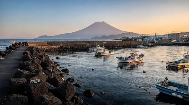
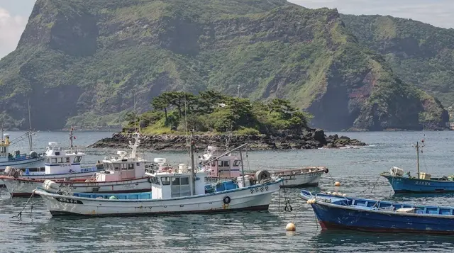
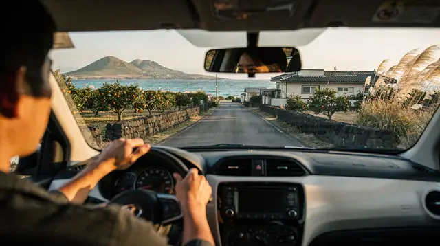
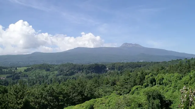

Seongpanak is the eastern trailhead of Hallasan National Park and the more heavily used of the two routes that reach the summit crater rim, chosen by most first-time hikers for its gentler grade despite a longer overall distance than the alternative Gwaneumsa trail on the western side.
| Where | Hallasan’s eastern slope |
| Cost | Free beyond the reservation; crampons ₩5,000-10,000/day in winter |
| Time needed | Full day, 8-9 hours round trip |
| Getting there | 30-40 min drive from Jeju City or Seogwipo |
| Best time | May-June and September-October, early morning start |
The trail from this side
The Seongpanak Trail runs about 9.6km one way to the summit, typically taking 8-9 hours round trip including rest stops — a genuine full-day commitment rather than a half-day outing. The trail’s defining characteristic relative to Gwaneumsa is its more forgiving, steadier grade: less technical rock scrambling, more sustained forest and subalpine walking, which is why it’s usually recommended to hikers attempting Hallasan for the first time or without serious mountain experience. The full trail breakdown, current conditions, and comparison against the other three trails are in the Seongpanak Trail guide and the complete Hallasan hiking guide.
The trailhead facilities
Seongpanak’s trailhead area has a visitor center with restrooms, basic information on current trail and weather conditions, and a small shop for last-minute supplies — the most developed trailhead facilities among Hallasan’s four access points. There’s no lodging directly at the trailhead itself; this is a day-use access point, not an overnight base, so plan to arrive by car, taxi, or the limited public bus service rather than expecting to stay nearby the night before.
Permits and timed entry
Like the other summit trail (Gwaneumsa), Seongpanak requires an advance online reservation through the Hallasan National Park system, with a daily hiker quota and a mandatory starting-time window — arriving without a reservation and expecting to start on a whim doesn’t work reliably, particularly on peak-season weekends in spring and autumn. Gate closing times are strict and calculated seasonally to get hikers back down before dark; rangers do turn back late arrivals at checkpoints. Check current reservation windows and cutoff times before your visit, since both shift with the season.
Guided options from this trailhead
For hikers who’d rather not navigate the reservation system and trail logistics independently, Jeju: Hiking Mt. Hallasan, South Korea’s Highest Mountain and Jeju: Mt. Hallasan Small-Group Nature Hike & Lunch both operate primarily via Seongpanak given its more accessible grade, bundling transport, a certified guide, and lunch into one booking — a genuine convenience given how much of the friction here is administrative rather than physical.
Getting here
Seongpanak trailhead is about 30-40 minutes by car from Jeju City and a similar distance from Seogwipo, reachable via a limited public bus schedule or, more reliably, by car or taxi. It’s on the island’s eastern side, making it a natural pairing with a broader day covering east Jeju sights if you’re not spending the full day on the mountain.
Mobile signal and emergency preparedness
Mobile signal is generally available along most of the Seongpanak trail given Korea’s dense network coverage, though it can weaken in certain forested or sheltered sections — worth noting for anyone relying on a phone for navigation or in case of emergency. Ranger stations and the rest points along the route provide a point of contact if something goes wrong, and hikers should note their approximate location relative to these points as they progress.
Packing specifics for a Seongpanak summit attempt
Beyond the general layering advice for any Hallasan hike, Seongpanak’s specific length means carrying more water and food than you might expect for a day hike elsewhere — at least 1.5-2 liters of water and enough calories (trail snacks, a packed lunch) to sustain 8-9 hours of sustained walking, since the rest points along the way offer only limited supplementary supplies. Trekking poles, while not strictly necessary given the trail’s relatively gentle grade, help noticeably on the descent, when tired legs and a long downhill stretch put more strain on knees than the ascent itself.
Photography along the way
While the dense lower forest limits long-distance views for much of the climb, it offers its own photographic rewards — filtered light through the canopy, moss-covered rock formations, and (in October) a genuine tunnel of autumn color. The payoff views open up dramatically in the trail’s final third, once you clear the tree line and the crater rim and surrounding peaks come into view; this is where most summit-hike photographs are taken, and it’s worth having a charged camera or phone ready rather than saving it only for the very top.
First-time hiker mistakes to avoid
The most common mistake first-time Hallasan hikers make on Seongpanak is underestimating the total time commitment and starting too late in the day, running into the mandatory gate cutoff before reaching the summit or being forced into a rushed, unsafe descent. A close second is inadequate footwear — sneakers rather than proper hiking shoes — which becomes a real problem on the trail’s rockier upper sections and during the long descent. Both mistakes are avoidable with basic preparation: start early, wear real hiking shoes, and respect the stated time estimates rather than assuming you’ll beat them.
Comparing Seongpanak and Eorimok
Seongpanak reaches the actual summit crater rim; the western Eorimok trailhead does not — its trail climbs toward Witse Oreum, a viewpoint below the crater, rather than the summit itself. Choose Seongpanak specifically if reaching the top is the goal; choose Eorimok if a shorter, less demanding hike with real scenery (without the reservation pressure of a summit attempt) fits your day better.
What a summit day from Seongpanak actually feels like
The lower third of the trail runs through dense forest with limited views — the payoff, subalpine terrain and eventually the crater rim, comes in the final third of the climb. Many hikers underestimate the psychological toll of this long, view-limited approach; pace yourself and don’t judge the hike’s worth until you’re above the tree line. Descending takes nearly as long as the ascent and is harder on the knees, so budget accordingly rather than assuming the way down will be quick.
Budget for a Seongpanak hike
The trail itself is free beyond the reservation system, which currently carries no separate charge. Costs come from getting to the trailhead (taxi or rental car), crampon rental in winter if needed (typically ₩5,000-10,000 near the trailhead), and food you carry yourself, since there’s no restaurant service on the mountain beyond basic rest-point facilities. A guided tour bundling transport, a certified guide, and lunch removes the reservation and logistics burden entirely, at a higher cost than doing it independently.
Seasonal notes
May-June and September-October generally offer the clearest summit weather and the most comfortable hiking temperatures. Winter (roughly December-March) brings snow and ice, often requiring crampons for a safe ascent, with occasional trail closures after heavy snowfall or high wind — check current conditions before a winter attempt. October is the busiest period given foliage season, so book reservations well ahead if that’s your target window.
Rest points and facilities along the trail
Seongpanak has two main rest points along its route before the summit, offering basic facilities (restrooms, a small amount of shelter, sometimes limited drink or snack sales) roughly at the trail’s midpoint and closer to the final approach. These aren’t full-service rest stops — don’t expect hot food or extensive supplies — but they provide a genuine, useful break point for pacing a long hike, and their presence is one practical reason Seongpanak feels more manageable to first-time summit hikers than it might otherwise, given the total distance involved.
What the forest sections look like through the seasons
The lower two-thirds of Seongpanak’s trail passes through mixed forest that changes character dramatically across the year — dense green canopy in summer that limits both views and direct sun exposure, vivid autumn color in October that makes the ascent itself a scenic destination rather than just a means to the summit, and a starker, more open winter forest after leaves drop, which paradoxically opens up more filtered views than the denser summer canopy allows.
Comparing the crowd levels to Gwaneumsa
Because Seongpanak is the more commonly recommended trail for first-timers, it also tends to draw larger crowds than the steeper Gwaneumsa route, particularly on weekend mornings in peak season. Hikers specifically seeking a quieter ascent, and who feel confident with the more technical terrain, sometimes choose Gwaneumsa for this reason alone, accepting the harder grade in exchange for fewer fellow hikers on the trail.
Camping and multi-day options near Seongpanak
While Hallasan itself doesn’t permit overnight camping along the summit trails, nearby recreational forest areas along the eastern approach roads offer camping options for visitors who want to be close to the trailhead the night before an early start, avoiding a longer pre-dawn drive from Jeju City or Seogwipo. This isn’t strictly necessary given the trailhead’s accessible drive time, but it’s worth knowing about for visitors building a multi-day hiking-focused itinerary around Hallasan and the wider oreum network.
Weather monitoring before your hike
Because Hallasan’s summit weather can differ substantially from conditions at sea level — clear skies on the coast don’t guarantee a clear summit — checking a mountain-specific forecast rather than the general Jeju weather forecast is worth the extra step before committing to a Seongpanak attempt. Some hikers build in a flexible day or two into their itinerary specifically to wait for a clearer weather window, particularly if summiting matters more to them than sticking to a fixed schedule.
Training and fitness preparation
Seongpanak’s 8-9 hour round trip catches out visitors who assume a national park hike will be a casual afternoon activity. It’s genuinely comparable in exertion to a long day of alpine hiking anywhere in the world — sustained walking with real elevation gain, on your feet for the better part of a day. Visitors coming from a sedentary routine benefit from at least a few weeks of regular walking or stair-climbing beforehand rather than attempting Hallasan as their first serious hike of a trip. It’s not a technical climb requiring specialized skills, but underestimating the cardiovascular and muscular demand is the single biggest reason hikers arrive at a rest point exhausted with hours still to go. Pacing yourself early, rather than pushing hard on the initially easier forest sections, pays off considerably by the time the trail steepens in its final third.
Seongpanak versus the other three trails
| Trail | Reaches summit | Round trip | Best for |
|---|---|---|---|
| Seongpanak | Yes | 8-9 hours | First-timers, gentler grade |
| Gwaneumsa | Yes | 7-8 hours | Experienced hikers wanting fewer crowds |
| Eorimok | No (Witse Oreum) | 3-5 hours | Shorter hike, winter snow scenery |
| Yeongsil | No (Witse Oreum) | 3-5 hours | Dramatic rock formations, shorter hike |
If Seongpanak’s crowds or full-day commitment don’t fit your trip, the Eorimok destination page and the complete Hallasan hiking guide cover the shorter alternatives in more depth.
Planning the days around your hike
A summit day leaves little energy for anything else, so it helps to plan the days on either side with care. Before the climb, the Hallasan permit system explained walks through the reservation logic, and the Hallasan hiking gear and safety guide covers what to carry. If you want a lower-stakes warm-up, a short oreum hike lets you test your shoes and pacing on a smaller volcanic cone first.
Afterwards, tired legs are best rewarded with an easy day. A relaxed meal of Jeju black pork or a soak at one of the spas and onsen makes a good recovery plan. If the weather turns and the summit is closed, the rainy day activities list and the weather by month page help you reshuffle the trip rather than lose it.
For a wider structure, the Hallasan hiking adventure itinerary places this trailhead inside a multi-day route, and the Gwaneumsa trail guide is the natural comparison if you are deciding between the two summit routes.
Frequently asked questions about Seongpanak
Is Seongpanak easier than Gwaneumsa?
It’s considered the gentler grade of the two summit trails despite being slightly longer in distance, which is why it’s usually recommended for first-time Hallasan hikers.
Do I need a reservation to hike from Seongpanak?
Yes, an online reservation with a set starting-time window is required for this summit trail, particularly during peak season.
Is there lodging at the Seongpanak trailhead?
No, it’s a day-use access point with a visitor center and basic facilities, not an overnight base — arrive the morning of your hike.
How long does the Seongpanak hike take round trip?
Typically 8-9 hours, depending on fitness, conditions, and rest stops — a full-day commitment.
Can beginners hike Seongpanak?
Reasonably fit beginners can manage it with good preparation, proper footwear, and an early start, but it remains a genuine full-day mountain hike rather than a casual walk.
What’s the best time to start a Seongpanak summit hike?
As early as gate hours allow — an early start gives more buffer against the mandatory descent cutoff time and generally better weather before afternoon cloud builds over the peak.
Are there rest stops with facilities along the Seongpanak trail?
Yes, two main rest points offer basic restrooms and limited shelter roughly at the midpoint and closer to the final approach, though don’t expect full food service.
Is Seongpanak more crowded than Gwaneumsa?
Generally yes, since it’s the more commonly recommended route for first-time hikers — Gwaneumsa’s steeper grade filters for a somewhat smaller, more experienced crowd.
Can I camp near the Seongpanak trailhead the night before?
Direct summit-trail camping isn’t permitted, but nearby recreational forest areas along the eastern approach roads offer camping options for an early start without a long pre-dawn drive.


